Congratulations, Argo program, for collecting over 2 million ocean profiles in 20 years!
- February 13, 2019
- Category: Flash info
The Argo program is an international ocean observation program that provides crucial data about the world’s oceans for oceanography, meteorology and climate studies. A few weeks ago, the Argo program reached an important milestone of over 2 million ocean profiles (measurements of temperature, salinity and pressure) collected since 1999.
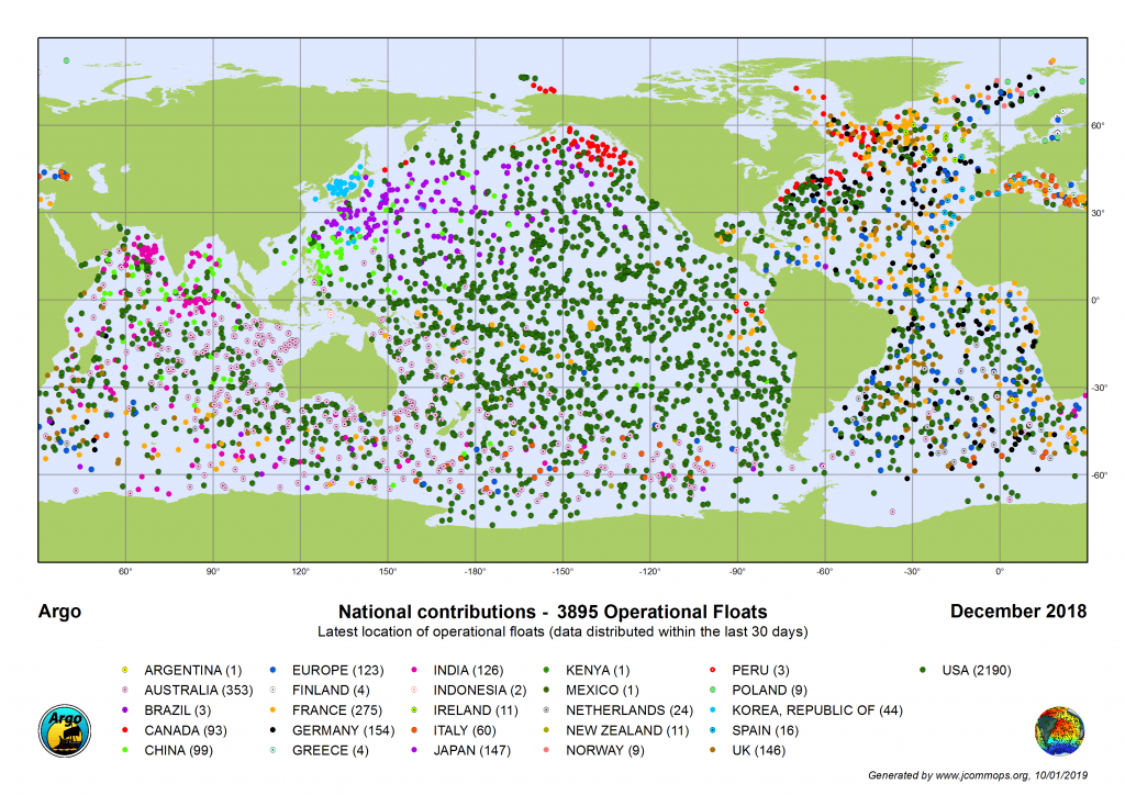
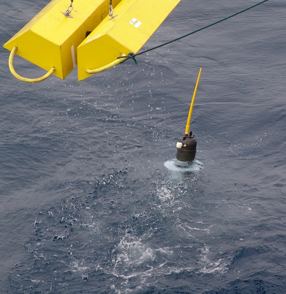
The ocean plays a central role in the earth’s climate. Yet continuous observations of the ocean are difficult to obtain, especially below the sea surface. The Argo program is a network of 4,000 autonomous profiling floats deployed by ship and pre-programmed to sample the ocean. Every 10 days, these instruments dive down to 2,000 meters below the sea surface then slowly rise to the surface, collecting temperature, pressure and salinity profiles as they go. These profiles are sent via satellite when the float reaches the surface. Once the data has been sent, the 10-day cycle begins again. Designed to complement other measurements, the Argo program provides the crucial, uniform in time and space, in situ observation profiles of the ocean.
CLS, key partner of ocean observing programs
CLS has been a key partner of the Argo program since its inception. The early Argo floats relied exclusively on the Argos system, operated only by CLS, to relay data from profilers to scientists. Since 1999, seventy percent of the 2 million Argo profiles were transmitted using the Argos system.
As a technical partner for Argo, CLS provides data processing and formatting to prepare data for insertion on the Global Telecommunication System (GTS) of the World Meteorological Organization (WMO). This crucial activity serves an important mission of the Argo program: fueling marine meteorology models by making data available to the Met Offices in near real-time.
Data hosting for international oceanography programs
The Argo Information Centre (AIC) is hosted on CLS servers and maintained by CLS in agreement with JCOMMOPS, the coordinating body of the WMO-UNESCO’s IOC that manages this ocean observation program. The AIC aims to widely coordinate Argo operations as well as to monitor in near-real time the status of the whole Argo array, thus optimizing its implementation across countries.
This is made possible thanks to CLS’ support which provides IT infrastructure and staff, ensuring high availability and 24/7 monitoring of the services.
CLS also performs quality-control services, by comparing dynamic height anomalies (DHA) measured by Argo floats and altimeters. CLS notifies the Primary Investigator, through the AIC, when variations occur, so that the faulty instruments can be corrected, and the erroneous data removed from operational weather and climate applications.
CLS, key telemetry provider for Argo
Today, CLS continues to provide both Argos and Iridium satellite telemetry services for the Argo program.
Furthermore, CLS provides a float data hosting service for interested clients and works closely with JCOMMOPS to improve data integrity and continue to ensure the highest level of service for Argo users worldwide.
Congratulations, Argo community!!!