Towards higher accuracy SST measurements with Trusted buoys
- September 16, 2019
- Category: Flash info
Sea Surface Temperature (SST) is one of the essential climate variables providing an indicator of the rate at which ocean temperatures are rising. In the open ocean, it can be measured in a number of ways – by satellite, ships, profiling floats and data buoys.
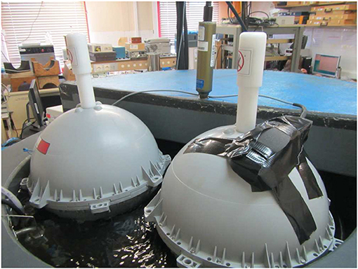
According to the Data Buoy Cooperation Panel (DBCP), drifting buoys provide about 90% of in-situ SST data today. In order to provide the most precise measurements of SST ever undertaken by drifting buoys and build a fiducial reference measurement (FRM) network for Copernicus Sentinel-3 satellites, the TRUSTED project consortium, led by CLS, has designed and developed a new type of drifting buoy, the SVP-BRST, manufactured by NKE.
The SVP-BRST sets new standards for SST measurements – by characterizing its sensors in the SHOM‘s metrology laboratory for greater precision. In addition, the buoys respond to EUMETSAT’s need for high resolution, reliable SST measurements for calibration of the Copernicus Sentinel-3 satellites, referenced to SI (Système International d’unités) with an error tolerance of less than 0.01°C.
A recent article “Development of Surface Drifting Buoys for Fiducial Reference Measurements of Sea-Surface Temperature” published in Frontiers in Marine Science reveals how the HR SST sensors on this new generation of SVP-BRST buoys are calibrated, and why this improvement is so important to tomorrow’s ocean observing systems.
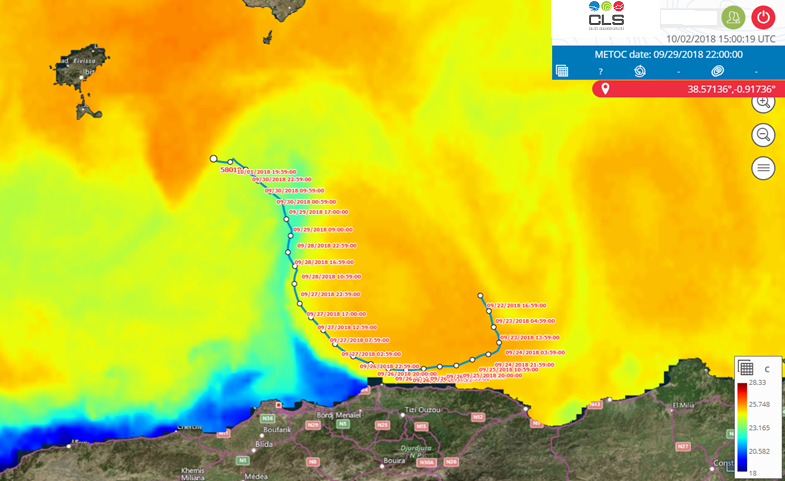
The method revealed in the article was tested in the Mediterranean Sea in 2018 with two prototype buoys during trials at sea led by SHOM. Further trials are undertaken by BSH. JCOMMOPS manages metadata. Today, an array of 100 HR SST buoys is being deployed by Météo-France across the globe to build a fiducial reference measurement network for space-based SST observations from Sentinel-3.
About the Trusted project
Setting new standards for HR SST measurements
A new chapter in the history of SST measurements
Delivery of the second batch of Trusted buoys
Project partners

About CLS
CLS, a satellite operator and partner of the ocean sciences community for more than 30 years, leads the Trusted project consortium. The Trusted buoys use Iridium SBD services provided by CLS to relay the HRSST data along with its position and other ocean parameters. In addition, CLS provides special processing services that make it possible to validate Sentinel-3 measurements and posts the data to the Global Telecommunication System (GTS) of the World Meteorological Organization (WMO) for inclusion in numerical weather forecasting models. CLS is also the exclusive Argos satellite services provider for scientific and environmental applications.