CLS helps improve the quality of in-situ data from Argo
- December 13, 2018
- Category: Flash info
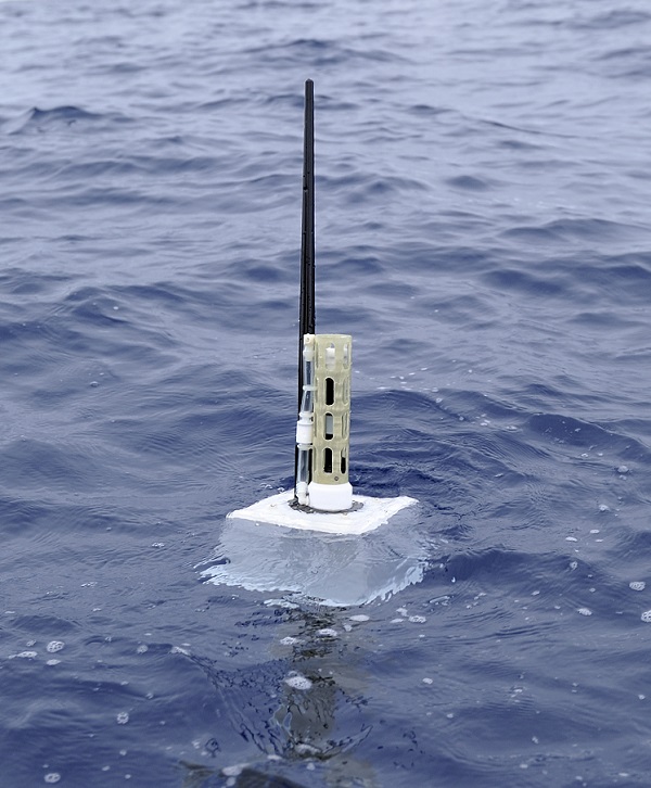
Argo is a major international ocean observing program that uses profiling floats to observe temperature, salinity, currents and biogeochemical parameters in the first 2,000 meters of the earth’s oceans. Since the early 2000s, the Argo profiling floats dcollect real-time data that is used in climate and oceanographic research. Today, more than 4,000 floats are active in the world’s oceans, gathering measurements down to 2,000 meters below the sea surface.
CLS services for the Argo program
CLS provides Argos and Iridium satellite telemetry services for most of these oceanographic instruments and special data hosting services for floats using Iridium RUDICS communication.
Once a year, the data managers of the international Argo program come together to discuss technical matters pertaining to the Argo data stream. This year was the 19th Argo Data Management Team meeting, hosted by Scripps Institution of Oceanography from December 2-7, 2018.
CLS attended this meeting to present the results of validation of profiling floats with satellite data from AVISO.
Validate Argo float data through comparison with altimeter observations
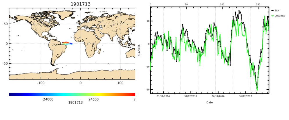
In order to quality control Argo float data, CLS, global expert in altimetry data, developed an algorithm to intercompare dynamic height anomalies (DHA) measured by Argo floats and altimeters. Argo floats time series are from the Coriolis GDAC and sea level anomalies (SLAs) are from AVISO multi-missions combined maps that are co-located in time and space to each Argo measurements.
Results show very good consistency between collocated SLA and DHA for the majority of profiling floats with quite stable agreement this year relative to the last years.
Every three months, this intercomparison allows CLS to identify anomalies in the dataset.
When this occurs, CLS notifies the Primary Investigator so that the faulty instruments can be corrected, and the erroneous data removed from operational weather and climate applications.