WORKSHOP: High-resolution sea surface temperature (HRSST) drifting buoys for satellite SST
- November 10, 2020
- Category: Event

Science Review Workshop on HRSST and TRUSTED
EUMETSAT, CLS and Météo France invite you to an online event, from 1 to 4 March 2021.
This workshop is an opportunity to discuss the many issues around the topic of high-resolution sea surface temperature (HRSST) measurements including the benefits brought about by such a network, how it compares to other similar initiatives, the impact of metrology, lessons learnt and recommendations for the future.
The aim of the review workshop is to gather an international independent assessment of HRSST drifting buoys, including those from the TRUSTED project.
The meeting shall present and discuss the latest developments on HRSST and the TRUSTED project, satellite SST validation activities and results with HRSST drifting buoys, and data access / availability and quality control.
The meeting shall bring together scientific and operational users of HRSST drifting buoys and drifting buoy data producers. The review shall assess whether the drifters are able to meet a HRSST-FRM designated standard and recommend a way forward.
About the TRUSTED Project
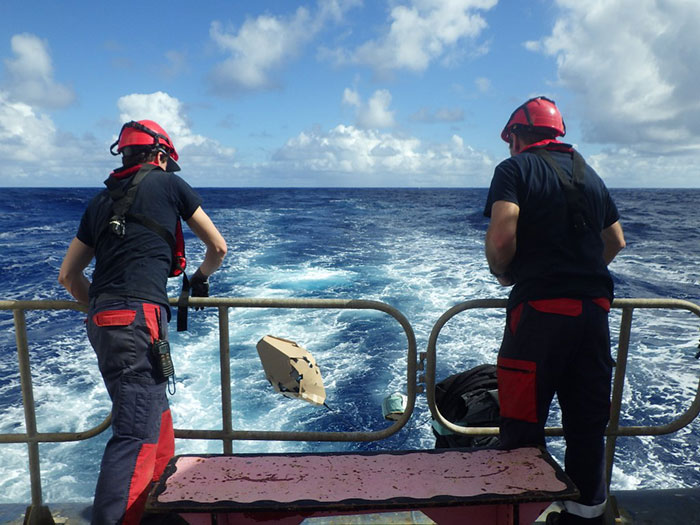
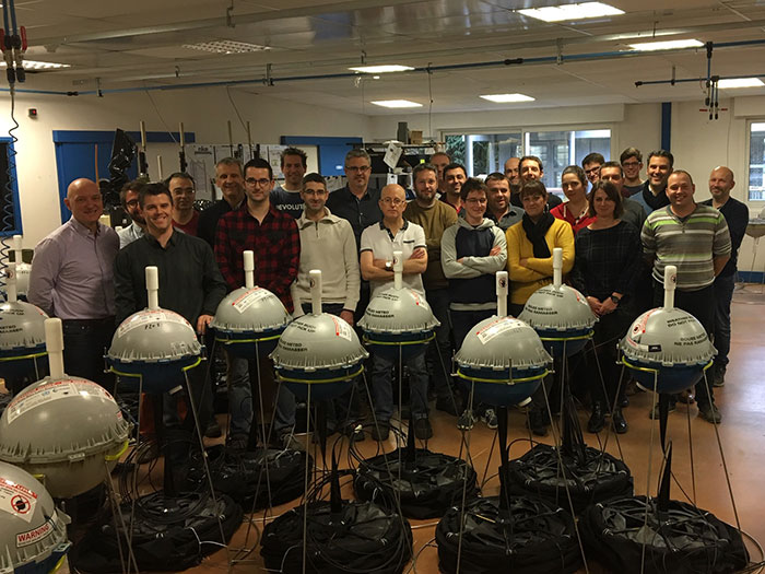
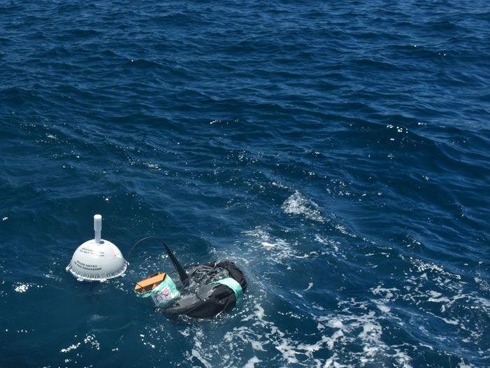
The European Union’s Copernicus-funded TRUSTED project (Towards Fiducial Reference Measurements of Sea-Surface Temperature by European Drifters) has deployed over 100 state of the art drifting buoys for improved validation of Sea Surface Temperature (SST) from the Sentinel-3 Sea and Land Surface Temperature Radiometers (SLSTR).

Who can participate?
The meeting is open to anyone interested in HRSST drifting buoys and their use for satellite SST validation and scientific / operational SST applications. A matchup dataset of SLSTR and TRUSTED buoy SST will be made available to those interested prior to the meeting.
Abstracts
Abstracts are welcome on any aspect of HRSST drifting buoys, and particularly their use with satellite SST. This includes topics covering the Global Drifting Buoy network and HRSST; towards Fiducial Reference Measurements and quality control of drifting buoys; drifting buoy applications in satellite SST; and satellite SST validation with HRSST and TRUSTED sensors.
There will also be a session from the Group for High Resolution Sea-Surface Temperature (GHRSST) on the Evaluation of HRSST drifters.
Abstract submissions and registrations are now closed.
Some organization elements of this workshop
Due to the Covid pandemic, it will be held in a virtual format. A limited number of places will be available at the Meteo France Facility in Saint Mandé near Paris for participants wishing to attend in person. Please contact the organisers for more information.
Contacts
Marc Lucas, CLS
mlucas@groupcls.com
Gilbert Emzivat, Meteo-France
gilbert.emzivat@shom.fr
Anne O’Carroll, EUMETSAT
anne.ocarroll@eumetsat.int
Abstract Presentations
Day 1 - Monday 1st March
Session 1 - From HRSST to Fiducial Reference Measurements from drifting buoys
Sentinel-3 validation team and the need for Fiducial Reference Measurements - Anne O’Carroll, EUMETSAT
The first Copernicus Sentinel-3 satellite, Sentinel-3A, was successfully launched on 16th February 2016 from Plesetsk, and the second, Sentinel-3B on 25th April 2018, with the mission to provide a consistent, long-term collection of marine and land data for operational ocean analysis, forecasting and service provision. Calibration and Validation activities are essential for satellite commissioning and in continuum. As a component of this, Fiducial Reference Measurements (FRM) are needed to deliver the required confidence in the data products for users, as outlined in the CEOS Quality assurance framework for Earth Observation (QA4EO), so we can understand how accurate the data products really are through full traceability. FRM are linked to a missions Calibration and Validation plan activities and building on the existing capabilities, forward thinking and long-term vision.
This presentation describes the Sentinel-3 validation team together with EUMETSAT Sea Surface Temperature (SST) validation activities, and explains the need for Fiducial Reference Measurements, particularly from drifting buoy SST. Progress over the last 10 years will be described, together information on from the Copernicus EUMETSAT ‘TRUSTED’ project since 2018. The presentation considers the steps and needs towards FRM drifting buoys. Measurement protocols should be documented, in long term, with high frequency and be satellite specific. Excellent calibration techniques should be employed. The steps towards full traceability to SI standards should be considered, together with access to metadata and additional measurements. There should also be the maintenance of historical metadata and then we can think whether the steps towards Fiducial Reference drifter measurements for satellite SST validation have been met. We can consider if it is possible to achieve a full Fiducial Reference from drifting buoys, given the requirements for SI traceability, or are considering instead a sub-set of very high quality Reference drifting buoys with the best calibration and documentation we can achieve.
In summary, a continuation of activities is needed towards maintaining and developing further a reference set of measurements (FRM) from drifting buoy SST. These are crucial for quantifying and ensuring the SLSTR SST product quality and validated uncertainties. It is also important to continue to assess and establish the benefit of improved capability of HRSST-2 drifting buoys for satellite SST validation, together with the HRSST Task Team activities of the Group for High Resolution Sea-Surface Temperature (GHRSST).
Reference drifting buoys within a harmonized sea surface temperature observing system - Chris Merchant, University of Reading
Key elements among the contemporary sea surface temperature (SST) observing system include (taking a broad perspective) reference-quality in situ measurements, a range of other in situ measurements, single-view and dual-view satellite observations, models (of various sorts) relating SSTs at different depths, and clear-sky radiative transfer models. This talk will discuss the role that reference drifting buoys can play within this observing system. The perspective taken will be that greater harmonisation and integration of the observing system is now possible, given theoretical and observational developments. The motives for attempting this and the roles that buoys such as TRUSTED buoys could have will be outlined.
Towards ‘fiducial reference measurements’ of sea surface temperature to underpin climate action - Nigel Fox, NPL
Session 2 - Global Drifting Buoy network and its support to HRSST FRM
The Impact and Value of the Data Buoy Cooperation Panel to the user community and its contribution to the global ocean observing effort - Boris Kelly Gerreyn, Australian Bureau of Meteorology
The Data Buoy Cooperation Panel (DBCP) is an international expert panel that facilitates the coordination of the deployment and operation of data buoys across contributing programs, in all oceans and their coastal seas. The data from these platforms help to measure critical climate variables and in doing so, underpin operational services that protect us from extreme weather events, help us understand and adapt to the changing climate and deliver science for improved knowledge of the oceans and their role and impact on the Earth system. All of this helps support resilience and sustainability in economies around the world while at the same time contributing to global efforts, such as the UN Decade of Ocean Science for Sustainable Development, to address the grand challenges facing our oceans and our planet.
For almost 4 decades, the DBCP has focused on observations at the air-sea interface and the upper ocean (from the surface to 15-20m depth) using both Lagrangian drifting and fixed moored buoys. This focus has been achieved through a collaboration built upon scientific expertise, trust and a strong global partnership among operational meteorological and oceanographic agencies, academic institutions that have been sustaining global scientific observing programs for decades, scientists, engineers and manufacturers.
This presentation will highlight some of the successes of the DBCP and then focus on where it is heading over the next decade to create significant impact and value for its users, in partnership with the global ocean observing community.
The Global Drifter Program - Luca Centurioni, Scripts
The GDP mission is scientific and includes studying the near surface global and regional ocean circulation, including marginal seas and high latitude regions, monitoring the global trends of sea surface temperature (SST) and of sea level atmospheric pressure (SLP) and understanding the role of the ocean in the intensification and decay of tropical cyclones and in the occurrence of extreme events, such as atmospheric rives. In recent years the GDP has begun in-situ monitoring of the global surface wave and their directionality, and a parallel effort to advance studies on the interaction of waves with ocean currents and their role in coupling the ocean and the atmosphere. The GDP data suite is relayed in real-time through satellite communication systems and, as such, plays a very important role in operational oceanography and ocean/weather forecasting through validation and data assimilation.Lagrangian drifters provide more in-situ SST observations than any other source, including ships (factor of about 4), coastal moorings (factor of about 4), tropical moorings (factor of about 50), or Argo floats (factor of about 100). Such SST data are essential for validation of satellite SST retrievals algorithms and are used to characterize their uncertainty and the long term stability of satellite SST products. Given their use as reference measurements for SST, it is crucial that the accuracy of temperature observations from drifters are carefully quantified and understood. The use of more accurate temperature sensors, with smaller drift, improved accuracy [(0.05 °C)], finer resolution [O(0.01 °C)] and of Global Positioning System (GPS) techniques for more accurate geolocation, is rapidly becoming a new standard for the GDP. Efforts are underway to standardize the temperature measuring methods for GDP drifters, and to harmonize them with the other requirements of the GDP mission.This talk will present the current status of the GDP SST sampling strategy, upcoming technical improvements and the current standardization efforts for traceable and sustainable temperature sensors. It will also explore ways to improve the interaction between the GDP and the end users of drifter SST data.
OceanOPS report at EU-funded HRSST TRUSTED drifters workshop - Mathieu Belbeoch & Long Jiang, OceanOPS
WMO-IOC Joint in situ Observations Programme Support Centre (OceanOPS, formerly JCOMMOPS) has been supporting the monitoring, coordination, and integration of data and metadata for the global oceanographic and marine meteorological observing systems over 20 years. By ensuring metadata standardization and interoperability across and within the global ocean observing network, OceanOPS has been delivering marine platform metadata for integrated and enhanced monitoring services.
Currently, OceanOPS tracks over 100,000 observations a day from the global networks, including some 1600 drifting buoys coordinated by the data buoy cooperation panel (DBCP). Through support of DBCP technical coordinator and colleagues at OceanOPS, all the deployed and planned 152 HRSST drifters of EU TRUSTED project have been timely and accurately recorded at OceanOPS web-based system with full details.
The TURSTED project on High Resolution Sea Surface Temperature (HRSST) drifting buoys showcases DBCP long lasting support to new technologies for proven successful innovations to improve buoy operations and data applications.
Trusted drifting buoys data processing, a collaborative work from Meteo-France, Ifremer and OceanOPS - Thierry Carval, Ifremer
Coriolis data centre is a joint program from CNES, CNRS, Ifremer, IRD, Meteo-France, Polar Institute and SHOM. Coriolis is the Data Assembly Centre (DAC) for European drifting buoys. As a DAC, it routinely collects, decodes, quality controls, preserves and distributes data and metadata as NetCDF-CF files. Within the buoys managed by Coriolis DAC, there are 154 Trusted drifting buoys manufactured by NKE. The trusted buoys have specific features managed by Coriolis DAC python data processing chain: a high resolution temperature sensor in addition to the classic drifting buoy temperature sensor. The high frequency and high resolution observations are distributed in specific variables TEMP_HR, TEMP_HR_XX (XX is the percentile sample). On buoy deployment, Météo-France declares the metadata to OceanOPS information system.Then, on a routine monthly mode, Meteo-France perfoms a survey of the deployed Trusted buoys and updates the buoys metadata on OceanOPS dashboard. Coriolis DAC metadata are synchronized with OceanOPS metadata. Data distribution : from the DAC, the NetCDF files are distributed to Copernicus Marine service (in situ TAC). CLS distributes Trusted data on GTS as buoy BUFR messages. The DOI for drifting buoys dataset is under preparation. It will be the FAIR persistent identifier for Trusted data citation, reservation and traceability (one-click download).
Day 2 - Tuesday 2nd March
Session 3 - HRSST applications
Using drifting buoys to estimate ocean circulation signal - Hélène Etienne, CLS
Since 2015, CMEMS (Copernicus Marine Environment Monitoring Center) InSitu Thematic Assembly Center (INS-TAC) provides to users a Delayed Time data set of near surface velocity measurements from surface drifters. This product integrates the NOAA AOML Surface Velocity Program (SVP) Drifter’s retreatment from 1990 to present days (year minus one.) SVP drifters have a drogue, centered at 15-m depth, to minimize direct wind forcing and Stokes drift. But a significant number (≈ 50%) of drifters lost their drogue and then go back to the surface. Undrogued drifter velocities are provided by CMEMS INS-TAC with a correction of the wind slip effect (Rio, 2012). The method has been upgraded to retrieve the unprocessed remaining ≈20% data, using an adaptative correlation window length (Etienne, 2018).
Wind slippage correction benefits from the evolution of the wind driven empirical model developed based on the Rio 2012 method and recently updated (Mulet et al, 2021). This method estimates a 2 parameters empirical model from the information of the surface drifting buoys velocity after removing the geostrophic component deduce from altimetry.
Wind slippage correction and Ekman current estimation have been used to estimate the ocean circulation signal content and help assessing the SKIM Sea surface KInematics Multiscale mission (Earth Explorer 9 candidate.) It shows the necessity for the in situ community to maintain and promote the ocean circulation observation network, at the surface to help future satellite mission design, and at depth for assimilation or captor’s synergy.
Use of surface drifters to compute Mean Dynamic Topography - Sandrine Mulet, CLS
The Mean Dynamic Topography (MDT) is a key reference surface for altimetry. It is needed for the calculation of the ocean absolute dynamic topography, and under the geostrophic approximation, the estimation of surface currents. Those are required for a wide range of applications as the management of fishery resources, the monitoring of potential pollution, maritime security… Also, the MDT is the missing component for the optimal assimilation of altimeter data into operational ocean system as those run under the Copernicus Marine Environment Monitoring Services (CMEMS).
CNES-CLS / CMEMS Mean Dynamic Topography solutions are calculated by merging information from altimeter data, GRACE and GOCE gravity data and oceanographic in-situ measurements (drifting buoy velocities, hydrological profiles). While satellite data (altimetry minus gravity) give a good estimate of the large-scale MDT, in-situ data (mainly the NOAA AOML Surface Velocity Program – SVP – Drifters) are mandatory to resolve small scales. Substantial pre-processing is needed on the drifter data to extract the geostrophic component of the signal to be consistent with the physical content provided by altimetry. This step includes estimating and removing the Ekman current, Stokes drift and wind slippage.
Objective of this communication is to present how drifters help to better resolve MDT and to introduce the last CNES-CLS18 global MDT and the CMEMS2020 Black Sea and Med Sea MDTs.
Pacific Gyre HRSST - Andy Sybrandy, Pacific Gyre
High resolution sea surface temperature measurements have been a hot topic recently in the world of global Lagrangian drifters. Sea surface temperature measurements, in the past have had a resolution of no better than 0.1C. Pacific Gyre strives to not only improve resolution, but also the accuracy of this measurement. Most Lagrangian drifters built by Pacific Gyre now include sea surface temperature sensors with resolution of 0.01C and an accuracy of 0.05C. We describe here the driving forces for this improvement, and the challenges of producing such a sensor.
On fitting SST temporal evolution models to the TRUSTED HRSST data - Shane Elipot, RSMAS
The SST data from the drifters of the TRUSTED project are used to fit the model of SST temporal evolution which is being used for generating the upcoming hourly SST dataset of the Global Drifter Program. This temporally-localized model intends on capturing SST variability on multiple timescales by including a diurnal component and a non-diurnal component. We consider two metrics to assess the performances of the model in fitting the standard SST data or the high-resolution SST data. The first metric is the root mean square value (RMS) of the model residuals and the second metric is the median of the standard errors. We consider these metrics for the total SST estimate and find that the model performs marginally better for both metrics when fitted to the high-resolution SST data compared to the standard SST data. Based on the model results, I will further focus on the differences in diurnal variability estimates between standard and high-resolution SST data.
Session 4 - TRUSTED overview
Overview of the TRUSTED project - Marc Lucas, CLS
Developing and manufacturing the SVP-BRST - Jérome Sagot, NKE
Contributions of metrology to the TRUSTED project - Marc LeMenn, SHOM
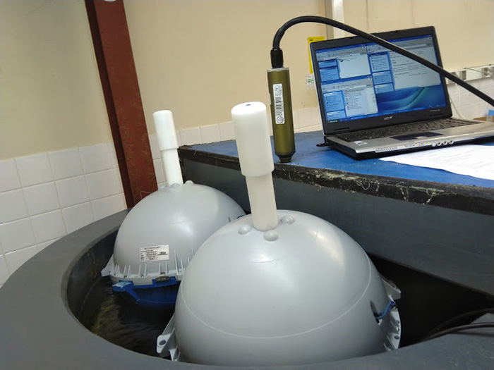
Quality assurance is widely used in industry, but relatively little in oceanography. Paragraph 7.1.5 of ISO-9001 makes the link between quality and metrology, and the TRUSTED project has been designed to address this paragraph, which states in summary that, where measurement traceability is a requirement, measuring equipment should be calibrated and/or verified before use against measurement standards that can be linked to international or national measurement standards. This was the first task of Shom’s metrology laboratory, concerning the MoSens modules designed for the project’s surface buoys. These modules were designed to be able to calibrate the HRSST sensors of the buoys in batches. These calibrations made it possible to establish a measurement uncertainty for each sensor and to detect manufacturing defects for some of them. Once integrated into the buoys, 15 buoys out of 150 were checked in the calibration bath to ensure the quality of the integration. The metrology work also demonstrated the benefits of a smaller temperature probe in terms of measurement accuracy and response time. Intercomparisons at sea realized with two buoys prototypes have highlighted the advantage of surface buoys over other means of comparing data measured by satellites. Finally, the initial calibration made it possible to estimate the drift of the HRSST sensor after a year of measurements at sea, using a buoy recovered from the Icelandic Sea and another which had been moored at a fixed position by the German Hydrographic Office.
Buoys deployments, Quality Control and Lifetime - Christophe Guillerm, Météo France
Buoy deployments all around the World,
Data Quality Control and exchange with partners.
Sensor performances
Vibration trial with a TRUSTED drifter and long-term comparison of a drifter with the MARNET-Station Northseabuoy-3 - Kai Herklotz, BSH
Day 3 - Wednesday 3rd March
Session 5 - HRSST evaluation, validation and GHRSST HRSST / MDB Task Team
AMT 29 validation - Werenfrid Wimmer, University of Southampton
With a number of satellite sensors providing high quality sea surface temperature (SST) products, the need for validation data of a similar quantity is increasing. This is especially true for the Copernicus Sentinel-3 Sea and Land Surface Temperature Radiometer (SLSTR). In order to address the need for such reference data sources EUMETSAT launched the Towards fiducial Reference measUrements of Sea-Surface Temperature by European Drifters (TRUSTED) project which is tasked to supply over 100 drifting buoys (HRSST-FRM) to provide fiducial reference data (FRM) for the SLSTR validation campaigns.
The initial calibration of the TRUSTED temperature probes is carried out in the NKE laboratory with the support of the SHOM (the French Naval Hydrographic and Oceanographic Service). To access the long term stability of the temperature probe (TRUSTED) in HRSST drifters , two of the TRUSTED temperature probes were installed in a flow through tank together with a NISST traceable high resolution temperature probe on the RRS Discovery in 2019 during AMT29. We will show the data collected during AMT29 and how the TRUSTED temperature probes performed over those six weeks of data collection. The collected data covers a range of temperatures from 283 K to 303 K with over 3.6 million data points. We also show a comparison with the NKE NOSS CTD cell and FRM data collected by infra-red radiometers during the cruise which are regularly used for satellite validation.
TRUSTED-SLSTR SST multi-mission matchup database and diagnostics - Igor Tomazic, EUMETSAT
Sea surface temperature (SST) is an essential variable for operational forecasting and global climate monitoring, and is one of the main products provided by the Copernicus Sentinel-3 Sea and Land Surface Temperature Radiometer (SLSTR) instruments. As such, there is a stringent requirement on SLSTR SST product performance: Its absolute accuracy should be better than 0.3 K and its temporal stability better than 0.1 K/decade.
One of the main SST Cal/Val activities to confirm these requirements is comparison with in situ reference measurements. To perform this activity we generate an SST multi mission matchup database (MMDB) using the felyx application, from which we then analyse differences between SLSTR SST and in situ SST measurements. Currently we are using several in situ measurement types: drifters, Argo, moorings and ship-borne radiometers and recently we added in situ measurements from HRSST drifters built and deployed through the EUMETSAT/Copernicus TRUSTED project. The full SLSTR SST MDB contains selected variables from SL1 and all from SL2 products (both SL_2_WCT and SL_2_WST), as well as the main variables available from the in situ datasets.
TRUSTED HRSST drifters contains additional measurements from well calibrated digital temperature probe and from near-surface water pressure sensor as well as additional parameters to improve quality control. In addition, selected drifters contain also high frequency measurements (1 Hz) to allow more detailed analysis. All available TRUSTED measurements and parameters are converted to daily NetCDF file of all drifters and combined with existing SLSTR SST MDB into auxiliary TRUSTED-SLSTR matchup dataset.
This presentation will summarise our TRUSTED-SLSTR SST MDB processing activities and respective format, give overview of the prepared TRUSTED drifter diagnostics and parameters to help in improving quality control and metadata handling.
Evaluation of HRSST drifters using Copernicus SLSTR - Gary Corlett, EUMETSAT
The first Copernicus Sentinel-3A Sea and Land Surface Temperature Radiometer (SLSTR-A) was launched on 16th February 2016. SLSTR-A is a multi-spectral dual-view radiometer with two on-board blackbodies and cooled detectors ensuring accurate radiometric measurements. SLSTR-A was joined in orbit by its twin, SLSTR-B, on 25th April 2018.
The quality of any satellite SST retrieval depends critically on the availability on high quality in situ datasets. Previous work estimated the accuracy of the drifting buoy network to be ~ 0.2 K. A pilot project has been re-established between GHRSST and the Data Buoy Cooperation Panel (DBCP) to address the accuracy of drifting buoys and their impact on satellite SST retrievals.
The joint GHRSST/DBCP activity is supported by the outputs of two recent studies, a EUMETSAT/Copernicus project (‘TRUSTED’) to build and deploy 150 high-specification High-Resolution SST (HRSST) drifters and an ESA-supported project on consolidating historical drifter SSTs and defining best practices for the future. The raw measurement data from the TRUSTED drifters, as well as a dedicated matchup database (MDB), have been shared with the GHRSST community in preparation for this workshop.
In this presentation we summarise initial results from validating SLSTR using HRSST drifters. In particular we show how SLSTR SST measurements are validated using measurements from various depths and how instrumental, spatial and temporal mismatch uncertainties are considered, including those of the drifters. We also show how the quality of the drifting buoy network as a whole has improved in recent years and present an assessment of the impact of the HRSST drifters on validation results.
Validation of satellite SST: Shallow vs Deep - Experience with Argo and considerations for HRSST - Andy Harris, University of Maryland
IST validation - Gorm Dybkjaer, Danish Meteorological Institute
Traditional drifting buoy measurements, from e.g. iSVP buoys, do not have the sufficient quality for validation and tuning of satellite Ice Surface Temperature (IST) products. Such buoy sensors most likely will be covered by snow after deployment, thus measuring temperature from somewhere inside the snow pack and not the snow skin temperature. It is crucial for the IST producer communities to have access to fiducial surface temperature observations from sea ice to improve IST products in the future.
The main objective for fiducial surface temperature measurements is to provide traceable, high precision data, at sufficient temporal and spatial resolutions. With snow surface warming and cooling rates up to 10 K/hour, in spring and autumn, the recording frequency shall preferable be around 10 minutes and the precision of the observations must be well below the goal accuracy requirement of the IST products, and no worse than half the goal requirement of 1 K.
The technology to measure fiducial ice surface temperatures exists today in 2 forms, 1) radiometric measurements, similar to satellite measurements, and 2) thermal measurements from Ice Massbalance Buoys, where termisters on a string measure the temperature profile from the air through the snow pack to the ice. The drawbacks of these two solutions are price and relatively complicated deployment procedure that requires dedicated personnel. We investigate new in situ concepts for monitoring of ice surface temperatures that are price efficient and easy to deploy.
Based on multiple data records from the integrated observation system in the DMI winter observatory in Qaanaaq, NW Greenland, we calculate the uncertainty of which new in situ observations concepts can measure the snow skin temperatures.
On the usage of in situ measurements in Satellite to In Situ match-up databases - Jean-François Piollé, Ifremer
In situ measurements are the main source for the continuous validation of geophysical parameters, such as the sea surface temperature (SST), measured by satellites. The in situ SST measurements come from a variety of platforms, mainly drifting buoys but also ships, moored buoys, Argo floats…. resulting in a large heterogeneity of these reference measurements in terms of depth of measurement, precision, uncertainties, calibration, sampling rate, sources of errors, all these properties usually unknown or not provided to the user. Beside in situ platforms provide measurements at point location while satellite provide indirect measurements integrated over a surface (about 1km2 for polar orbiting infra-red sensors) at a depth (first micrometers or millimeters from sea surface) not accessible to in situ sensors, and therefore both types of measurements can not be directly compared. This presentation will summarize the different processes and issues related to the comparison of satellite and in situ observations, and will suggest some recommendations in order to ease and improve the usage of in situ data for the validation of satellite sea surface temperature.
Considerations of HRSST usage - Gary Corlett, EUMETSAT
Validation of TRUSTED buoy network for use in SST analysis - Martin Lange, Deutscher Wetterdienst
Validation of TRUSTED buoy network for use in SST analysis. Buoys from the TRUSTED network are deployed continuously since end of 2018. Data are put to GTS in bufr format and used by national meteorological services (NMS) in SST analysis since then. In this talk an assessment is made on the temporal development of the distribution (i.e. location and drift), reporting frequency and quality with respect to OSTIA based analysis in comparison with the existing buoy and ship measurement network. It will also be covered the desire for a unique assignment of the TRUSTED data within the data pool of all SST measurements. A special indicator in the metadata section of the bufr data provided by the data producer (if not already existing, and missed by the author) would facilitate retrieval, tracking of new buoys and monitoring or validation tasks. This last point is left for discussion.

